Learn bits
Ecology & Environment
Mahesh

24/05/22 08:52 AM IST
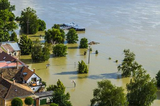
Assam Floods

In News 
  • Torrential rainfall and landslides in the past few days have eroded sections of roads and railway tracks in Assam's Dima Hasao district affecting road and rail connectivity to the Barak Valley region of the state.
  • Communication lines have also snapped in several parts of the north-east region.
Why is Assam prone to floods?
  • Brahmaputra is braided and unstable in its entire reach in Assam except for a few places. The main reasons behind the instability of the river are high sedimentation and steep slopes.
  • High percentage of flood prone region: 31.05 lakh hectares of the total 78.523 lakh hectares area of the state is prone to frequent floods. And the reasons behind this high flood prone area percentage are both man-made and natural.
  • EARTHQUAKES/LANDSLIDES: Assam and some other parts of the northeastern region are prone to frequent earthquakes, which causes landslides. The landslides and earthquakes send in a lot of debris in the rivers, causing the river bed to rise.
  • BANK EROSION: Assam has also faced bank erosion around the Brahmaputra and Barak rivers as well as their tributaries. It is estimated that annually nearly 8000 hectares land is lost to erosion. Bank erosion has also affected the width of the Brahmaputra river, which has increased up to 15 km.
  • DAMS: Among the man-made reasons, the key cause of floods in Assam region is releasing of water from dams situated uphill. Unregulated release of water floods the Assam plains, leaving thousands of people homeless every year.
  • Unplanned expansion of the urban areas has led to severe encroachments in the wetlands, low lying areas, hills and shrinkage of forest cover.
  • Guwahati’s topography — it’s shaped like a bowl — does make it susceptible to water logging.
Measures 
  • Studying the river and the impact of climate change is a must to understand why the state gets flooded every year.
  • Water flow information shared by China on the Brahmaputra with India, for which India pays a certain amount, should also be shared with the public, as this will help in understanding the river better and therefore help people better prepare for floods.
  • More accurate and decentralised forecasts of rain can help in improving preparedness. Weather reports should be made available on district level and should be accessible to public.

Source- PIB 

More Related Current Affairs View All

10 Jan

Rural landowners in Delhi want repeal of Sections 33 and 81 of Delhi Land Reforms Act

'Both sections dealing with the use and sale of agricultural land have come under the spotlight ahead of the Delhi Assembly elections.' This can only be done by the Central gove

Read More

10 Jan

Pravasi Bharatiya Diwas

'Prime Minister Narendra Modi inaugurated the 18th edition of the Pravasi Bharatiya Diwas  in Bhubaneswar.' The event is held once every two years to “honour the cont

Read More

10 Jan

Deciphering the Indus script

'Recently, Tamil Nadu Chief Minister M.K. Stalin announced a $1-million prize for experts or organisations in the event of their success in deciphering the scripts of the Indus Val

Read More

India’s First Ai-Driven Magazine Generator

Generate Your Custom Current Affairs Magazine using our AI in just 3 steps