26/09/21 18:45 PM IST

What is new about Landsat 9?
The Landsat 9 joins Landsat 8 that was launched in 2013 and the satellites together will collect images of Earth’s surface. It takes 8 days to capture the whole Earth.
Landsat 9 carries instruments similar to the other Landsat satellites, but it is the most technologically advanced satellite of its generation. It can see more colour shades with greater depths than the previous satellites, helping scientists capture more details about our ever-changing planet.
The instruments aboard Landsat 9 are the Operational Land Imager 2 (OLI-2) and the Thermal Infrared Sensor 2 (TIRS-2). They will measure different wavelengths of light reflected off the Earth’s surface.
OLI-2 can see the light that we can’t see too. It captures sunlight reflected off Earth’s surface and studies the visible, near-infrared, and short wave infrared portions of the spectrum.
TIRS-2 has a four-element refractive telescope and photosensitive detectors that capture thermal radiation and help study the Earth’s surface temperature.
As the satellite orbits, these instruments will take pictures across 185 kilometers and each pixel will represent an area of about 30 meter X 30 meter.
Secretary of the Interior Deb Haaland, said in a release that Landsat 9 will provide data that can help make science-based decisions on key issues such as impacts of wildfire, coral reef degradation, the retreat of glaciers, and deforestation.
“Landsat 9 will be our new eyes in the sky when it comes to observing our changing planet,” said Thomas Zurbuchen, associate administrator for science at NASA in a release. “Working in tandem with the other Landsat satellites, as well as our European Space Agency partners who operate the Sentinel-2 satellites, we are getting a more comprehensive look at Earth than ever before. With these satellites working together in orbit, we’ll have observations of any given place on our planet every two days. This is incredibly important for tracking things like crop growth and helping decision-makers monitor the overall health of Earth and its natural resources,” Zurbuchen said.
Why this satellite was launched?
Landsat 9 has been launched by NASA to monitor the earth's surface. The satellite would be monitoring the changes that the Earth is seeing in its landscapes and its environment etc.
Landsat 9 along with its sister satellite Landsat 8 would capture the images of Earth's land and coastal areas to find any changes that are taking place in the environment and landscape of the planet. It would take 8 days to circle the Earth which means one would get to see the complete image of the planet every 8 days. The satellite was launched from Vandenberg Space Force Base in California. The launch of Landsat-9 is a major milestone in the approximate 50-year joint partnership between USGS and NASA As per NASA Administrator Bill Nelson, “NASA uses the unique assets of our own unprecedented fleet, as well as the instruments of other nations, to study our own planet and its climate systems.” The landsat satellites capture the images of agricultural productivity along with forest cover, health and water quality, coral reef habitat along with glacier dynamics.
Landsat consists of the following instruments
When Landsat satellite was launched?
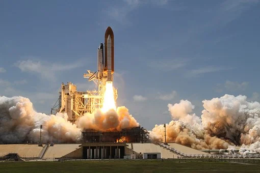
The Landsat program is the longest-running enterprise for acquisition of satellite imagery of Earth. It is a joint NASA / USGS program. On 23 July 1972, the Earth Resources Technology Satellite was launched. This was eventually renamed to Landsat 1 in 1975. The most recent, Landsat 9, was launched on 27 September 2021.
The instruments on the Landsat satellites have acquired millions of images. The images, archived in the United States and at Landsat receiving stations around the world, are a unique resource for global change research and applications in agriculture, cartography, geology, forestry, regional planning, surveillance and education, and can be viewed through the U.S. Geological Survey (USGS) "EarthExplorer" website. Landsat 7 data has eight spectral bands with spatial resolutions ranging from 15 to 60 m (49 to 197 ft); the temporal resolution is 16 days. Landsat images are usually divided into scenes for easy downloading. Each Landsat scene is about 115 miles long and 115 miles wide (or 100 nautical miles long and 100 nautical miles wide, or 185 kilometers long and 185 kilometers wide).
Where does Landsat store the images?
Landsat satellites make contact with a ground station every few hours and offload its data.
Mike O’Brien, ground station engineer of USGS told NASA in an interview : “Every time a Landsat 8 image comes in, I record on four independent different pieces of equipment. That way, if there’s a failure, I still have three other great copies.”
Karen St. Germain, director of the Earth Science Division at NASA Headquarters in Washington said in a release: “For nearly 50 years, Landsat satellites observed our home planet, providing an unparalleled record of how its surface has changed over timescales from days to decades. Through this partnership with USGS, we’ve been able to provide continuous and timely data for users ranging from farmers to resource managers and scientists. This data can help us understand, predict, and plan for the future in a changing climate.” One of the great advantages of remote sensing is that it provides data at a broader and more global level that is otherwise impossible to gather when using conventional equipment. Remote sensing provides information about geographic spaces, like ecosystems that allows scientists to predict the distribution of species, as well as detecting both natural occurring and anthropogenic generated changes in a greater scale than traditional data provided by field work. It also presents data more accurately than models that are derived from field work. The different bands in Landsat, with diverse spectral range provide highly differentiated applications.
Who proposed these satellites?
In 1965, William T. Pecora, the then director of the United States Geological Survey, proposed the idea of a remote sensing satellite program to gather facts about the natural resources of our planet. Pecora stated that the program was “conceived in 1966 largely as a direct result of the demonstrated utility of the Mercury and Gemini orbital photography to Earth resource studies.” While weather satellites had been monitoring Earth’s atmosphere since 1960 and were largely considered useful, there was no appreciation of terrain data from space until the mid-1960s. So, when Landsat 1 was proposed, it met with intense opposition from the Bureau of Budget and those who argued high-altitude aircraft would be the fiscally responsible choice for Earth remote sensing. Concurrently, the Department of Defense feared that a civilian program such as Landsat would compromise the secrecy of their reconnaissance missions. Additionally, there were also geopolitical concerns about photographing foreign countries without permission. In 1965, NASA began methodical investigations of Earth remote sensing using instruments mounted on planes. In 1966, the USGS convinced the Secretary of the Interior, Stewart Udall, to announce that the Department of the Interior (DOI) was going to proceed with its own Earth-observing satellite program. This savvy political stunt coerced NASA to expedite the building of Landsat. But, budgetary constraints and sensor disagreements between application agencies (notably the Department of Agriculture and DOI) again stymied the satellite construction process. Finally, by 1970 NASA had a green light to build a satellite. Remarkably, within only two years, Landsat 1 was launched, heralding a new age of remote sensing of land from space.
The Hughes Aircraft Company from Santa Barbara Research Center initiated, designed, and fabricated the first three Multispectral Scanners (MSS) in 1969. The first MSS prototype, designed by Virginia T. Norwood, was completed within nine months, in the fall of 1970.
The program was initially called the Earth Resources Technology Satellites Program, which was used from 1966 to 1975. In 1975, the name was changed to Landsat. In 1979, President of the United States Jimmy Carter's Presidential Directive 54 transferred Landsat operations from NASA to National Oceanic and Atmospheric Administration (NOAA), recommended development of a long term operational system with four additional satellites beyond Landsat 3, and recommended transition to private sector operation of Landsat. This occurred in 1985 when the Earth Observation Satellite Company (EOSAT), a partnership of Hughes Aircraft Company and RCA, was selected by NOAA to operate the Landsat system with a ten-year contract. EOSAT operated Landsat 4 and Landsat 5, had exclusive rights to market Landsat data, and was to build Landsats 6 and 7.
How will the satellite help monitor climate change?
If a forest is affected by drought, it will be seen in Landsat images and can help the researchers decode the areas at risk. Similarly during a wildfire, the Landsat images will capture the plumes of smoke and help study the extent of a burning. The satellite images can also help recovery experts plan sites for replanting.
Landsat images can also help identify water bodies affected by potentially harmful algal blooms. According to NASA, scientists are now developing computer programs that would use Landsat and other satellite data to automatically warn lake recreation managers when blooms pop up.
Landsat images have helped glaciologists study the melting ice sheets of the Antarctic and Arctic regions. The images can help track cracks in the glaciers, movement of glaciers, and decode how further global warming will impact them.
17 Sep
'Dehradun and several other districts in Uttarakhand have experienced very heavy rainfall over the past few days, triggering landslides in multiple areas and causing rivers to swel
Read More
08 Sep
'The Rajasthan Coaching Centres (Control and Regulation) Bill, 2025, is a significant piece of legislation passed by the Rajasthan Assembly to regulate and oversee the state's burg
Read More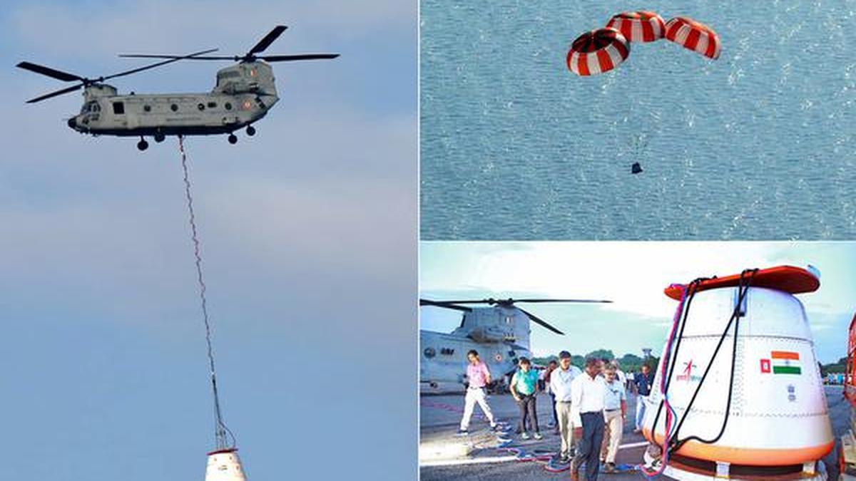
28 Aug
'Recently, the Indian Space Research Organisation (ISRO) successfully carried out its first Integrated Air Drop Test (IADT-1), a crucial milestone in the preparation for the countr
Read More