Learn bits
Polity & Governance
Mahesh

07/01/23 08:19 AM IST
National Geospatial Policy 2022

In News
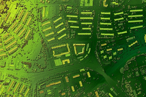
  • The National Geospatial Policy 2022 recently notified is aimed to set up high resolution topographical survey and mapping, with a high-accuracy Digital Elevation Model (DEM) for the country by 2030.
Features of the policy
  • A Geospatial Data Promotion and Development Committee (GDPDC, will be a 17-member body) at the national level shall be the apex body for formulating and implementing strategies related to promotion of the Geospatial sector.
  • GDPDC would replace and subsume the functions and powers of the National Spatial Data Committee (NSDC) constituted in 2006 and GDPDC constituted in 2021.
  • To develop a coherent national framework in the country and leverage it to move towards a digital economy and improve services to citizens.
  • To develop Geospatial infrastructures, Geospatial skill and knowledge, standards, Geospatial businesses.
  • To promote innovation and strengthen the national and sub-national arrangements for generation and management of Geospatial information.
Geospatial Technology
  • Geospatial Technology is an emerging field of study that includes Geographic Information System (GIS), Remote Sensing (RS), and Global Positioning System (GPS).
  • It has applications in almost every domain of the economy ranging from -
  • Agriculture to industries,
  • Development of urban or rural infrastructure,
  • Administration of land,
  • Economic activities of banking and finance, resources, mining, water, disaster management, social planning, delivery services, etc.
  • It enables government systems, services, and initiatives to be integrated using ‘location’ as a common and underpinning reference frame.
Survey of India
  • The origins can be traced back to the time of Lord Clive, who commissioned a major-ranking officer to produce a map of Bengal.
  • It was established in 1767 to help consolidate the Indian territories of the British East India Company .
  • It is India’s principal mapping agency and functions under the Department of Science and Technology (DST), Ministry of Science and Technology, Government of India.
  • Its chief responsibility is to ensure that India’s domain is explored and mapped appropriately.
  • It also provides base maps for expeditious and integrated development of the country by ensuring that all resources contribute to the progress, security and prosperity of the nation for the present and the future.
  • Survey of India is headquartered in Dehradun, Uttarakhand.
  • It is headed by the Surveyor-General of India.
Source- Financial Express

More Related Current Affairs View All

05 Mar

First-ever comprehensive survey of India’s river dolphins

'Prime Minister Narendra Modi released the results of the first-ever comprehensive population estimation of riverine dolphins – Gangetic and Indus dolphins – done in In

Read More

05 Mar

Arresting women at night

'The Madurai Bench of the Madras High Court in Deepa versus S. Vijayalakshmi and Others ruled that the legal provision in the Bharatiya Nagarik Suraksha Sanhita (BNSS), 2023, which

Read More

05 Mar

Digital Personal Data Protection Act, 2023

'The Ministry of Electronics and Information Technology (MeitY) looking to wrap up public consultations on the draft Rules for the Digital Personal Data Protection Act, 2023 by Mar

Read More

India’s First Ai-Driven Magazine Generator

Generate Your Custom Current Affairs Magazine using our AI in just 3 steps