13/12/20 16:16 PM IST

What is Mt.Everest?
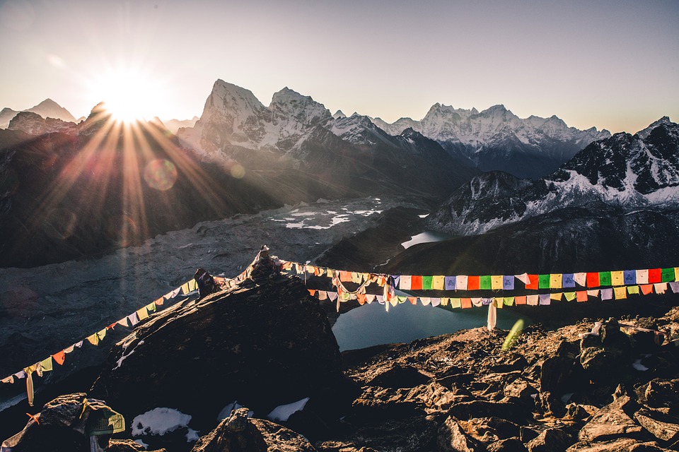
Mt. Everest is mountain on the crest of the Great Himalayas of southern Asia that lies on the border between Nepal and the Tibet Autonomous Region of China, at 27°59′ N 86°56′ E. Reaching an elevation of 29,035 feet (8,850 metres), Mount Everest is the highest mountain in the world. In the nineteenth century, the mountain was named after George Everest, a former Surveyor General of India.
The Himalayan mountains have long been home to indigenous groups living in the valleys. The most famous of these are the Sherpa people. The word “Sherpa” is often used to mean a mountain guide, though it refers to an ethnic group. The Sherpa have valuable experience in mountain climbing, which they can provide to other climbers. Most climbs of Everest would be impossible without the Sherpas’ logistical help and knowledge. Traditionally, their lifestyle has consisted of farming, herding, and trade. And, because they live at such a high altitude year-round, they are accustomed to the low oxygen levels.
There is very little native flora or fauna on Everest. Moss grows at 6,480 metres (21,260 ft) on Mount Everest. It may be the highest altitude plant species. An alpine cushion plant called Arenaria is known to grow below 5,500 metres (18,000 ft) in the region. According to the study based on satellite data from 1993 to 2018, vegetation is expanding in the Everest region. Researchers have found plants in areas that were previously deemed bare.
Mount Everest has a polar climate (Köppen EF) with all months averaging well below freezing. Tenzing Norgay and Edmund Hillary made the first official ascent of Everest in 1953, using the southeast ridge route. Norgay had reached 8,595 m (28,199 ft) the previous year as a member of the 1952 Swiss expedition.
Why did Mount Everest's height change?
The world's highest mountain is now officially a little higher, and that might not be the end of the story. The mountain’s height changes. The movement of tectonic plates can lift it ever so gradually, while earthquakes can bring it down. Today, the Indian plate continues to be driven horizontally below the Tibetan Plateau, which forces the plateau to continue to move upwards.
Mt. Everest or more correctly Himalayan along with the Alpine chain of mountains have replaced the huge Tethys sea thanks to the collision of the Indian-Australian and Asiatic plates, moving respectively in a northward and southward direction. Part of mantle and crust of these plates hence churned out and is getting deposited there levelling the Tethys sea of the past. Continuous such deposition has increased the height of the area and turned it into chains of mountains i.e. Alpine and Himalayan.
This process of raising height will continue till the area assumes tectonic stability or isostatic equilibrium. Or till the root of Himalayas reach to such depth to balance its mass or till the heavier Indian plate stop moving into the Asiatic one. Or for some reason good knows. But by the time it will attain isostatic equilibrium perhaps plates would have moved and merged at such places and in such directions that the present placing of continents would have changed mind knowingly.
The Indian plate is still moving at 67 mm per year, and over the next 10 million years it will travel about 1,500 km into Asia.
When mountains are formed?
Mountain formation refers to the geological processes that underlie the formation of mountains. These processes are associated with large-scale movements of the earth’s crust (plate tectonics).
Mountain formation is related to plate tectonics. Folding, faulting, volcanic activity, igneous intrusion and metamorphism are all parts of the orogenic process of mountain building. The understanding of specific landscape features in terms of the underlying tectonic processes is called tectonic geomorphology, and the study of geologically young or ongoing processes is called neotectonics. The Himalaya in Asia formed from one such massive wreck that started about 55 million years ago. Thirty of the world’s highest mountains are in the Himalaya. The summit of Mount Everest, at 29,035 feet (8,850 meters), is the highest point on Earth.
Types of Mountains
Movements of tectonic plates create volcanoes along the plate boundaries, which erupt and form mountains. A volcanic arc system is a series of volcanoes that form near a subduction zone where the crust of a sinking oceanic plate melts and drags water down with the subducting crust. Most volcanoes occur in a band encircling the Pacific Ocean (the Pacific Ring of Fire), and in another, that extends from the Mediterranean across Asia to join the Pacific band in the Indonesian Archipelago.
When plates collide or undergo subduction (that is–ride one over another), the plates tend to buckle and fold, forming mountains. Most of the major continental mountain ranges are associated with thrusting and folding of orogenesis. Examples are the Balkan Mountains, the Jura and the Zagros mountains.
When a fault block is raised or tilted, block mountains can result. Higher blocks are called horsts and troughs are called grabens. A spreading apart of the surface causes tensional forces. When the tensional forces are strong enough to cause a plate to split apart, it does so much that a centre block drops down relative to its flanking blocks. An example of this is the Sierra Nevada Range.
Where did the new measurement started?
Until the devastating earthquake of April 2015, Nepal’s Survey Department had perhaps never considered the idea of measuring Mt Everest. But the earthquake triggered a debate among scientists on whether it had affected the height of the mountain.
The government subsequently declared that it would measure the mountain on its own, instead of continuing to follow the Survey of India findings of 1954.
New Zealand, which shares a bond with Nepal over the mountain, provided technical assistance. Sir Edmund Hillary, the first climber on the peak along with Nepal’s Tenzing Norgay in May 1953, worked as the mountain’s undeclared brand ambassador to the world. In May 2019, the New Zealand government provided Nepal’s Survey Department (Napi Bibhag) with a Global Navigation Satellite, and trained technicians. Christopher Pearson, a scientist from University of Otago, travelled to Nepal on a special assignment.
Who was the first to climb the Mt. Everest?
A time when Everest was uncrowded and unpolluted, when only three expeditions had succeeded in putting men on its summit when attempts at climbing the peak were an undertaking at the very limits of human endeavour.
At 11:30 a.m. on May 29, 1953, Edmund Hillary of New Zealand and Tenzing Norgay, a Sherpa of Nepal, become the first explorers to reach the summit of Mount Everest, which at 29,035 feet above sea level is the highest point on earth. The two, part of a British expedition, made their final assault on the summit after spending a fitful night at 27,900 feet. Today, hundreds of mountaineers manage the feat each year thanks to improvements in knowledge, technology, and the significant infrastructure provided by commercially guided expeditions that provide a veritable highway up the mountain for those willing to accept both the risks and a hefty price tag.
And Avtar Singh Cheema (1933–1989) was the first Indian man and sixteenth person in the world to climb Mount Everest.[1] Along with 8 others, he was a part of the third mission undertaken by the Indian Army, in 1965, to climb Mt.
Junko Tabei became the world’s first woman to reach the summit of Mt. Everest, the world’s highest peak, on May 16, 1975. Her passion was propelled in part by the quest to defy odds, challenge stereotypes and prove wrong the chauvinist notion that doubts the ability of women to achieve goals like climbing Earth’s highest point. She was from Japan.
And on May 23 in 1984, Bachendri Pal became the first Indian woman to reach the summit of Mount Everest. The Great Indian Women's Rafting Voyage and First Indian Women Trans-Himalayan Expedition. She was from Nakuri, UttarakhandHow Mount Everest got 3 ft higher, endorsed by both Nepal and China?
China and Nepal settled their border dispute in 1961 with the boundary line passing through the summit of Mount Everest. With the new announcement, the country, which shares Everest with Nepal, has for the first time agreed upon a mutually accepted height. Chinese surveyors have conducted six rounds of scaled measurement and scientific research on Mount Everest and released the height of the peak twice in 1975 and 2005, which was 8,848.13 metres and 8,844.43 metres respectively.
The latest findings, however, have for the first time brought Nepal and China together.
Both Nepal and China conducted their own, independent studies and arrived at the same conclusion. Nepal had concluded its studies last year while China concluded its studies earlier this year.
The two nations have signed an MoU, agreeing on the new height of Everest. The historic declaration is being lauded by both China and Nepal, with the latter calling Mt Everest as "age-old symbol" of the ties with China.
Beijing also said that the declaration marked the beginning of a "new era" of a strategic partnership with Nepal. While the news of Everest's new height does not come as a surprise to India, the growing footprint of China in Nepal, coupled with its strengthening diplomatic ties with the Himalayan nation may be a cause of concern for India. While India and Nepal have always maintained peace and diplomacy via a multitude of treaties and agreements, recent years have seen Indo-Nepalese relations deteriorate. The joint declaration may be construed by India as yet another means of Chinese assertion following a year of tense Indo-China relations.
17 Sep
'Dehradun and several other districts in Uttarakhand have experienced very heavy rainfall over the past few days, triggering landslides in multiple areas and causing rivers to swel
Read More
08 Sep
'The Rajasthan Coaching Centres (Control and Regulation) Bill, 2025, is a significant piece of legislation passed by the Rajasthan Assembly to regulate and oversee the state's burg
Read More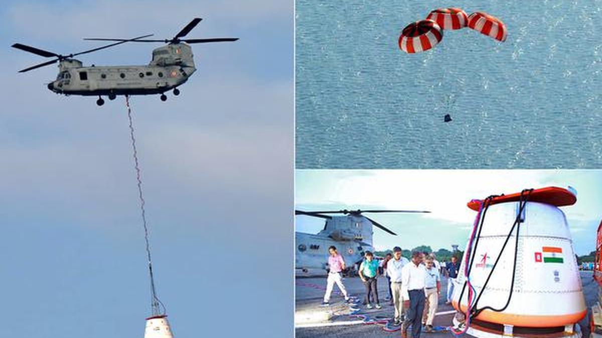
28 Aug
'Recently, the Indian Space Research Organisation (ISRO) successfully carried out its first Integrated Air Drop Test (IADT-1), a crucial milestone in the preparation for the countr
Read More